Best Hiking Trails In Queensland Tips
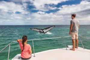
Queensland is home to some of Australia’s most spectacular hiking trails that wind through lush rainforests, along white sand beaches, and to the tops of scenic mountains. For outdoor enthusiasts looking to explore the diverse natural landscapes of Queensland, there are trails to suit all levels and interests. 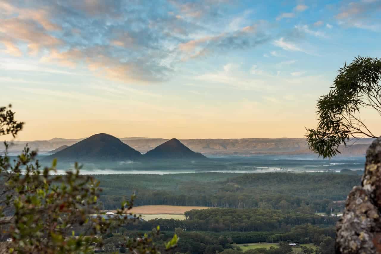
From short and easy coastal paths to multi-day hikes through remote wilderness, Queensland’s trails allow you to experience waterfalls, spot unique wildlife, take in panoramic views, and discover secluded swimming holes.
In this article, we highlight 10 of the best hiking trails Queensland has to offer for your next adventure. Whether you’re a beginner or an avid hiker, you’ll find an incredible trail perfect for you in Queensland.
[ez-toc]
Gold Coast Hinterland Great Walk
The Gold Coast Hinterland Great Walk shows off some of the best scenery in Queensland. This 54km trail winds through dense eucalyptus forest, alongside cascading waterfalls, and up to panoramic lookouts in the McPherson and Springbrook Ranges of the Gold Coast hinterland. The walk features a combination of ancient volcanic peaks, cliffs, rainforests, and wildflowers.
The track can be done in short sections or completed over 3 days as a multi-day hike. For those short on time, the 10km section through the Currumbin Valley is highly recommended. It passes through ferny glades and by the spectacular Currumbin Rock Pools. The pools are a series of small, crystal clear pools and cascades that provide a great place for a rest or a swim.
One of the highlights of the Great Walk is the Tweed Range Scenic Rim section. This part of the trail climbs up through lush rainforest to the Springbrook Plateau. At 910 meters above sea level, the plateau offers magnificent views over the Gold Coast and Pacific Ocean. Other scenic highlights include Twin Falls and Natural Bridge, located a short detour off the walking track.
While the Gold Coast Hinterland Great Walk requires a moderate level of fitness, the excellent trail conditions make it achievable for most hikers. With its variety of scenery, waterfalls, and panoramic views, this trail provides the perfect introduction to hiking in the Gold Coast hinterland region.
Mt Barney National Park
For experienced hikers looking for a challenging trek, Mt Barney National Park is considered one of Australia’s best multi-day hikes. The park is located about 120km southwest of Brisbane and is known for its rugged peaks, cliffs, and gorges. The main hike is the Mount Barney Traverse, a 24km route that can be completed over 2-3 days.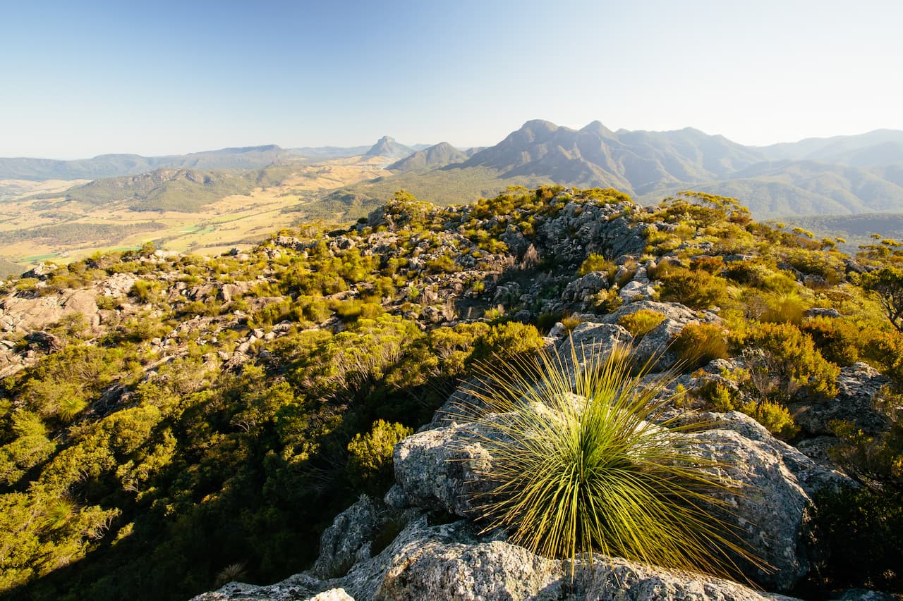
The hike starts from the Yellow Pinch picnic area and heads up Mount Barney Creek. This steep climb up to 1200 meters leads hikers past tumbling waterfalls like Thorsbourne Falls and MacDonald Falls.
The trail then meets Peasants Ridge before the final ascent up South Ridge to the 1351-meter summit of Mount Barney. The views from the summit are spectacular, looking over the Logan River Valley.
The second day involves climbing up and over Mount Maroon before descending into Rathburn Gorge. This steep and rocky gorge descent is challenging but rewards hikers with sights of palm-fringed cliffs and swimming holes. Once through the gorge, the final leg of the hike follows the cool, fern-lined Maroon Creek back to the starting point.
For experienced bushwalkers able to handle scrambling over boulders and rockhopping, Mount Barney Traverse will provide a thrilling physical challenge. The constantly changing scenery, from rainforest to creeks and cliff edges, also makes it one of the most scenic multi-day hikes in Queensland. Just be prepared for changeable weather on these high, exposed peaks.
Carnarvon Gorge
Carnarvon Gorge is an oasis in the semi-arid heart of Central Queensland. This narrow, lush gorge winds through sandstone cliffs up to 200 meters high, creating a shaded sanctuary from the harsh sun. Numerous hiking trails of varying difficulty run through Carnarvon Gorge, allowing hikers to explore its diverse landscapes and Aboriginal rock art.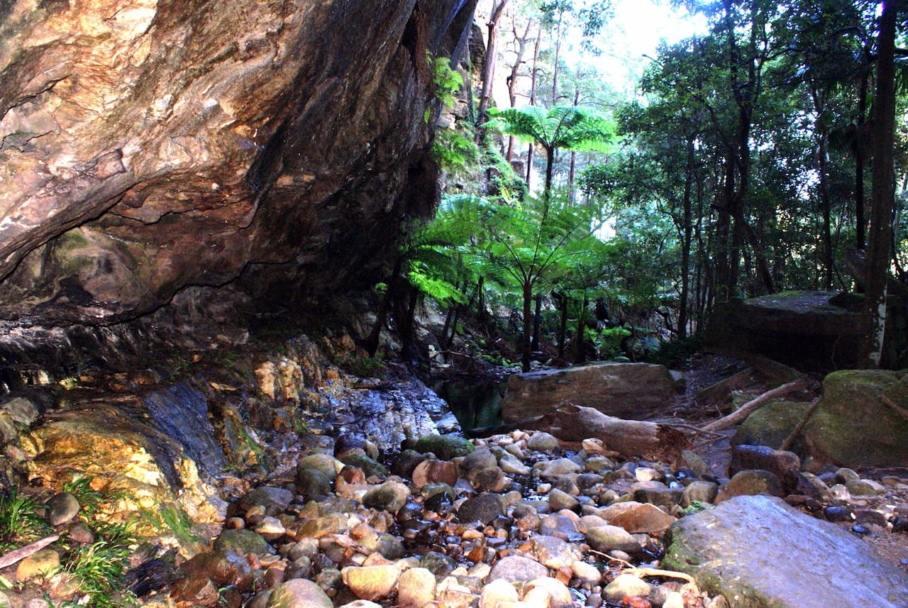
The main track is an easy 9km route that follows Carnarvon Creek from the Gorge visitor center to Big Bend. It passes through beautiful pools perfect for swimming alongside ancient paperbark and cabbage palm trees.
Side trails split off to various points of interest like the Moss Garden, the Art Gallery, and the Amphitheatre. The Amphitheatre is an impressive natural rock bowl featuring acoustics ideal for a performance.
For more avid hikers, the longer trails delve deeper into the gorge to sites like the Sphinx Rock. This is an imposing sandstone formation shaped like the Great Sphinx of Giza. Another challenging trail summits Mount Moffatt, which towers 800 meters above the gorge floor. The views over the gorge make the steep 5km climb worthwhile.
The ancient Aboriginal rock art found throughout the gorge provides an insight into indigenous culture thousands of years ago. Hiking Carnarvon Gorge is the best way to experience the blend of nature, culture, and history that makes this park so special.
With its moderate grades and well-marked trails, it appeals to hikers of all skill levels looking to discover the red cliffs, eucalypts, and hidden gorges of the Australian outback.
Whitsunday Island Trail
For a coastal hike combining beautiful beaches with lush rainforest, the Whitsunday Island Trail on Whitsunday Island is a must-do. This 30km trail circles the island, which lies within the Whitsunday Islands National Park offshore from Airlie Beach.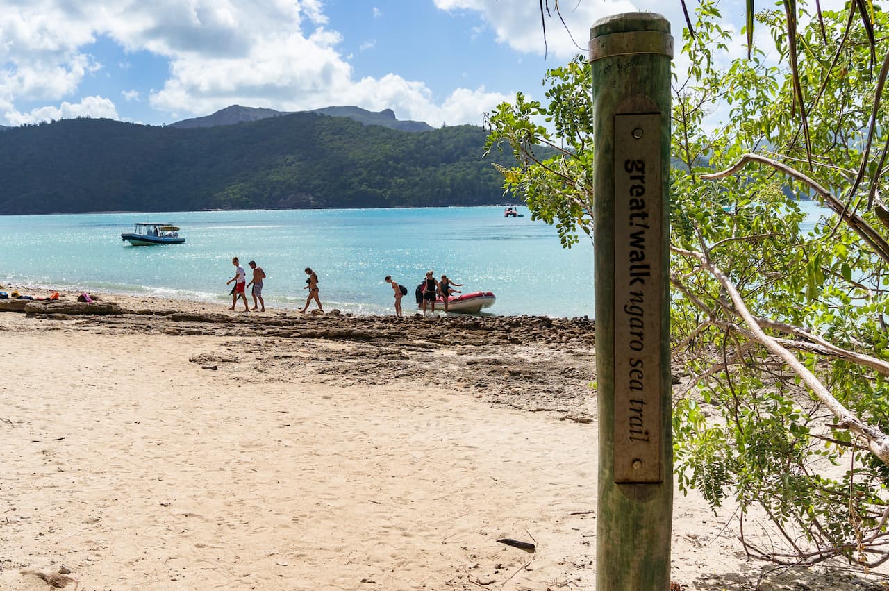
The trail can be hiked in sections or completed in 2-3 days as a camping trip. It sticks close to the coastline for most of the way, overlooking dazzling turquoise bays and coves.
Passing by Chance Bay, the southern section features some of the most pristine beaches in Queensland. Bright white silica sand lined with palms and pines makes this part of the trail feel like paradise.
Inland, the trail cuts through diverse vegetation, from thick palms to eucalyptus woodlands. Shirley Creek provides a great place to rest and cool off with a swim before tackling the climb to the 209-meter summit of Whitsunday Peak. The panoramic views from the top over Whitehaven Beach, Haslewood Island, and beyond are phenomenal.
The changing scenery, wildlife spotting opportunities, and deserted beaches make this coastal trail the ideal way to experience the beauty of the Whitsundays.
While certain sections are steep and rocky, the well-defined path caters to most fitness levels if done over multiple days. Walking this trail proves you don’t need to sail the islands to find secluded coves and postcard views in this famous Australian sailing destination.
Fraser Island Great Walk
Fraser Island, the world’s largest sand island, offers a unique hiking experience along its Great Walk trail. This 90km track traverses the length of the island, winding through rainforests, sand dunes, mangroves, and along long stretches of beach.
Starting at Dilli Village in the north, the walk passes through the Valley of the Giants, a stand of Satinay trees that are over 1000 years old. Further south, Eli Creek provides a cool, freshwater swimming spot. The creek flows out to the ocean, perfect for rinsing off salt water after walking sections of the seemingly endless Seventy-Five Mile Beach.
Inland, the trail cuts through tropical brush, paperbark swamps, and sandblows, where wind has shaped the sand into massive dunes. Lake McKenzie provides a perfectly clear blue freshwater lake for swimming surrounded by white sands.
The combination of coastal and inland scenery makes every day of the Great Walk unique. Other highlights include crossing Crystal Creek and hiking through the rainforest around Central Station. Most hikers take 4-5 days to complete the walk, camping along the way.
While long, the trail is relatively flat and easy to follow. Starting the walk at Dilli Village provides a convenient endpoint at Happy Valley, where most visitor accommodation is located.
With its mix of landscapes and rich biodiversity, Fraser Island’s Great Walk shows off the beauty of this World Heritage-listed gem located just off the Queensland coast.
Cooloola Great Walk
Located in Cooloola National Park along the Sunshine Coast, the Cooloola Great Walk is a 102km long trail that traverses a variety of landscapes. The walk follows the beachline, lakes, and creeks and passes through both wallum heathlands and eucalypt forests. With its diverse scenery, spotting kangaroos and birdlife is common along the trail.
Starting from Noosa North Shore, the walk heads south, following Teewah Beach. During low tide, the hardpacked sand provides pleasant hiking and uninterrupted views of the ocean.
The beach section ends at Freshwater campground, with a detour option to admire the colored sands at Rainbow Beach. From here, the trail cuts inland, circling lakes and meandering through wilderness for several days.
Highlights include swimming beneath the crystal clear waters at Lake Cootharaba and the stillness of Elanda Point surrounded by paperbark trees. Most hikers take 5-6 days to complete the walk, camping overnight in national park campgrounds.
While some inland sections of the Cooloola Great Walk are occasionally overgrown, the trail is relatively well-marked and easy to follow.
The landscape variety, fishing opportunities, lake swimming, and remoteness of this 3-6 day hike showcase the rugged beauty of the Sunshine Coast hinterland. With careful trip planning, the Cooloola Great Walk appeals to most hikers looking for diversity and challenge on Queensland’s longest marked trail.
Lamington National Park
Lamington National Park, located in the Gold Coast hinterland, contains over 160km of scenic hiking trails through lush subtropical rainforest.
The park lies along the McPherson Range, with elevations between 600 to 1100 meters, providing cooler temperatures and diverse vegetation. The complex trail network provides day hikes for all skill levels, as well as extended backpacking trips.
Some notable walks include the Border Track, a moderate 11km circuit passing by mountain lookouts and waterfalls. The Tree Top canopy walk gives unique aerial rainforest views along a gentle 1.5km route.
For those seeking a challenge, the Stinson Wreck walk is recommended. This strenuous 13km trail descends 800 vertical meters into ancient Gondwana rainforest to reach the crashed World War II plane.
The park is renowned for its high biodiversity, with many birds, reptiles, and animals like swamp wallabies and echidnas potentially spotted while hiking.
The trails showcase picturesque waterfalls and swimming holes, including Elabana Falls and Moran’s Falls. With so many interconnected trails, hiking combinations and loops can provide new scenery over multiple days in Lamington.
With its extremely high annual rainfall, Lamington National Park delivers the quintessential Australian rainforest experience. Well-marked trails give hikers access to a stunning green world of palms, ferns, and vines.
Just remember to pack wet weather gear, as muddy conditions are likely on these ancient tracks through one of Queensland’s most beautiful national parks.
Glass House Mountains
The Glass House Mountains are a series of volcanic plugs that rise dramatically from the Sunshine Coast plain. Their conical shapes and forested peaks make them a popular destination for hikers looking to combine scenic vistas with a physical challenge. Located just a one-hour drive north of Brisbane, the Glass House Mountains National Park provides summit trails of varying difficulty.
For an easy hike with panoramic views, the 1.5km path up Mt Ngungun is recommended. The summit provides a 360-degree view over the entire Glass House Mountain range and coastline.
A more challenging ascent is the steep 2.8km hike to the top of Mt Tibrogargan. Rewarding fit hikers with sweeping vistas, this trail involves scrambling over giant boulders with the aid of a handrail and ladder.
Another peak to conquer is Mt Beerburrum, accessed by a 6km roundtrip trail that passes an old lava tunnel before climbing to the summit. Many hikers aim to summit several peaks in one day, with Mt Ngungun, Tibrogargan, and Beerwah making a satisfying trio.
While demanding due to their steep gradients, all the Glass House Mountain trails are clearly signposted and mapped. Their proximity to the Sunshine Coast also makes them very accessible.
For hikers able to handle the rough, uneven terrain, ascending these volcanic formations provides a unique summit experience showcasing the geology that shaped the Queensland landscape.
D’Aguilar National Park
Situated only 45 minutes drive northwest of Brisbane, D’Aguilar National Park offers superb hiking amongst scenic reservoirs and forests. The 50km of walking tracks provide options for short strolls or overnight hikes. Popular trails include the 6km return walk to Tallow Wood Gorge, which involves rock hopping along a creek to a sunny rock pool perfect for swimming.
For more experienced hikers, the 21km Cabbage Tree Creek Circuit provides a challenging full-day hike through eucalypt forest, with creek crossings and a steep ascent rewarded by views from Mount Glorious. Other scenic trails visit the shores of Lake Manchester, Brisbane’s main drinking water supply, or the summit of Mount Nebo, the highest peak in the national park at 588 meters.
An abundance of wildlife inhabits the park, including wallabies, echidnas, platypus, and over 150 species of birds. Wildflowers blossom on the forest floor during the spring months. Well-marked trails also pass remnants of Brisbane’s early timber-cutting history, like the Tree Top Walk, highlighting logging practices through tree stumps and equipment.
With its close proximity to Brisbane, variety of trails, and diversity of scenery from waterfalls to summits, D’Aguilar National Park makes for fantastic day hikes or overnighters. The easily accessible national park provides a perfect taste of Queensland bush and mountain landscapes for hikers of all skill levels who live in or are visiting Brisbane.
Bunya Mountains Trail
Rising up to 1,135 meters, the Bunya Mountains provide a hidden retreat in the Queensland outback. The Bunya Mountains National Park contains over 140km of walking tracks showcasing the beauty of this unusual range. Hiking trails pass through lush pockets of rainforest, stands of ancient bunya pines, and scenic lookouts with panoramic views.
The relatively cool climate up in the mountains makes hiking pleasant, even in summer. The park features many waterfall swimming holes to provide relief from the heat, like the popular Paradise Falls.
On easier walks, visit secluded lakes or explore botanic loops spotlighting the diversity of flora. More challenging all-day hikes summit peaks like Mount Kiangarow or Mount Mowbullan for sweeping vistas over the plains.
Conclusion
Queensland has an abundance of world-class hiking trails that showcase the diversity of landscapes and environments found within the state. From beach walks to mountain climbs and rainforest circuits to rocky outcrops, there are trails suitable for all fitness levels and hiking experiences.
Iconic multi-day walks include the breathtaking scenery of Fraser Island, Whitsundays, and the Gold Coast Hinterland. More remote trails in national parks like Carnarvon Gorge, Mt Barney, and Cooloola provide wilderness adventure.
Many great hiking destinations like Lamington National Park and the Glass House Mountains are within easy reach of major cities.